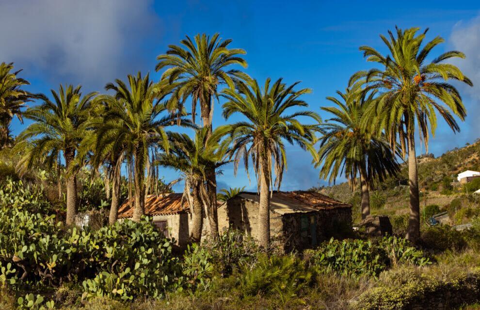
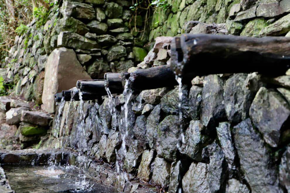
The GR 132.1 is an inland variant that connects the area of Las Rosas with the Chorros de Epina, offering a transitional route between the agricultural landscapes of the north and the forest formations associated with the laurel forest (monteverde). Covering just over twelve kilometres, the itinerary passes through one of the most representative municipalities in northern La Gomera: Vallehermoso. The route begins near the Las Rosas reservoir, from where a gradual ascent starts, soon leaving the track to follow dirt paths. In the initial sections, fayal–brezal woodland predominates, alternating with patches of laurel forest in the more humid areas. As the route progresses, the landscape opens up, revealing for the first time the unmistakable silhouette of Roque Cano, a monumental volcanic plug that visually dominates the entire valley. The descent towards Vallehermoso offers wide views of the town centre and its terraced slopes. Canary juniper gradually becomes more prominent as altitude decreases, shaping a drier and brighter landscape on the exposed hillsides. After crossing the town — where the trail connects with other hiking routes — the path resumes its climb along the opposite slope. The ascent is steady and provides views over the surrounding ravines, where small traditional orchards survive in contrast to abandoned terraces. The light-coloured, eroded terrain reveals the ancient volcanic materials that outcrop in this northern part of the island. As elevation increases, juniper woodland alternates once again with areas of monteverde favoured by the growing influence of the trade winds. The trail follows ridge lines that allow panoramic views on both sides of the terrain, until the forest becomes denser, forming a more enclosed fayal–brezal where tree heather and firetree create a cool, shaded atmosphere. In its final stretch, the route links with forest tracks and local roads before heading definitively towards the Chorros de Epina, a traditional site associated with springs and local legends. Surrounded by vegetation and holding strong symbolic value for the local population, this place marks the natural end of the branch and its connection with the main GR 132 route. Overall, the GR 132.1 is an inland alternative that reveals the landscape diversity of northern La Gomera: from agricultural valleys dominated by imposing roques to juniper-covered ridges and humid forests that herald the presence of the monteverde. A varied and demanding route that complements the coastal experience of the main circular trail.