


Discover the legacy of the walking route: Route of the Hamlets
La Gomera


Distance from Point A to Point B / Vallehermoso – Ermita de Santa Clara: 4.6 km
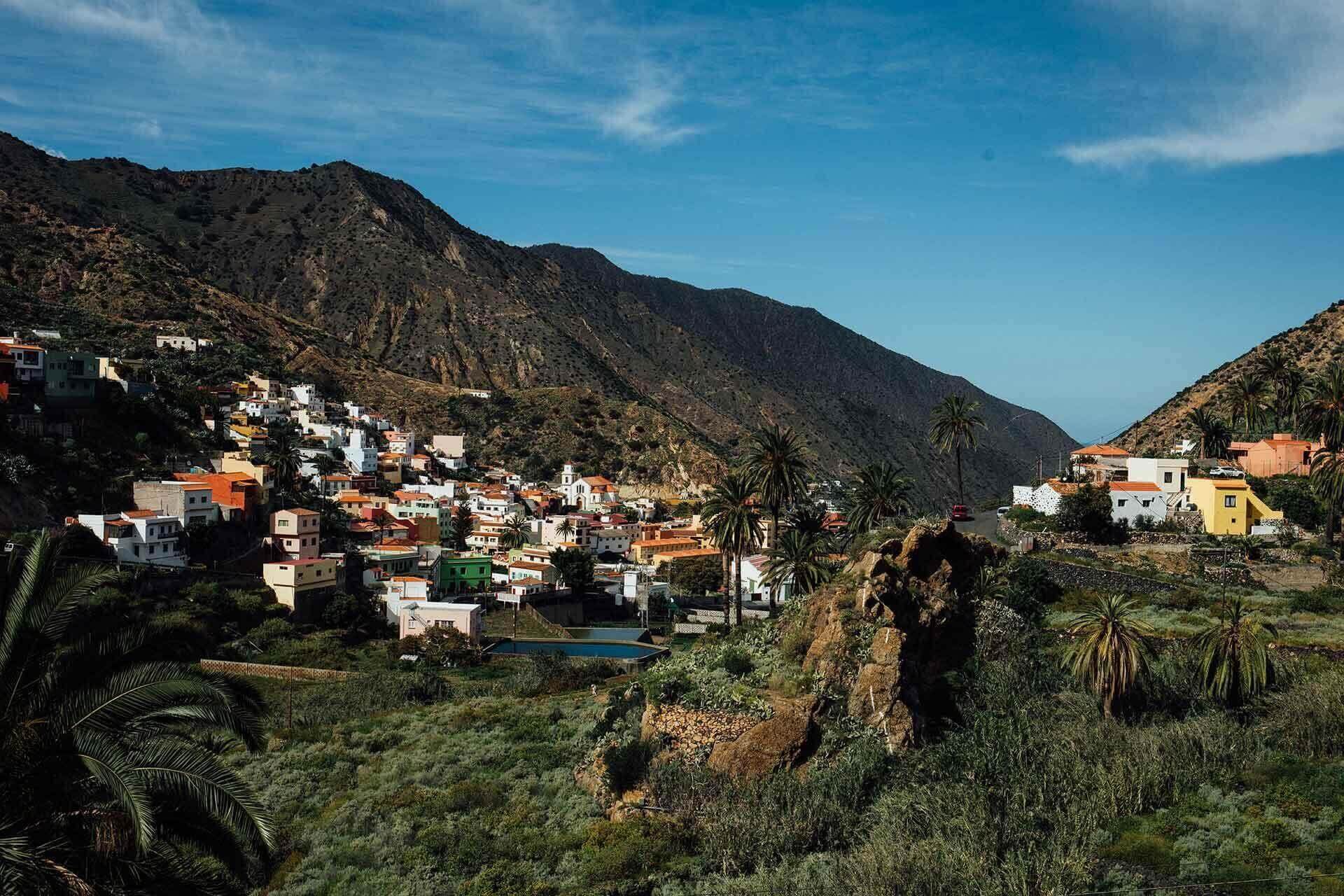
The route from Vallehermoso to Santa Clara starts in the centre of the village and climbs along traditional paths that reveal the agricultural history of the valley. Along the way, the trail crosses the Barranco de La Era Nueva, formerly known as the Barranco de los Franceses, and leads past old stone threshing floors and terraced fields that recall the production of gofio, an essential food in Gomero culture.
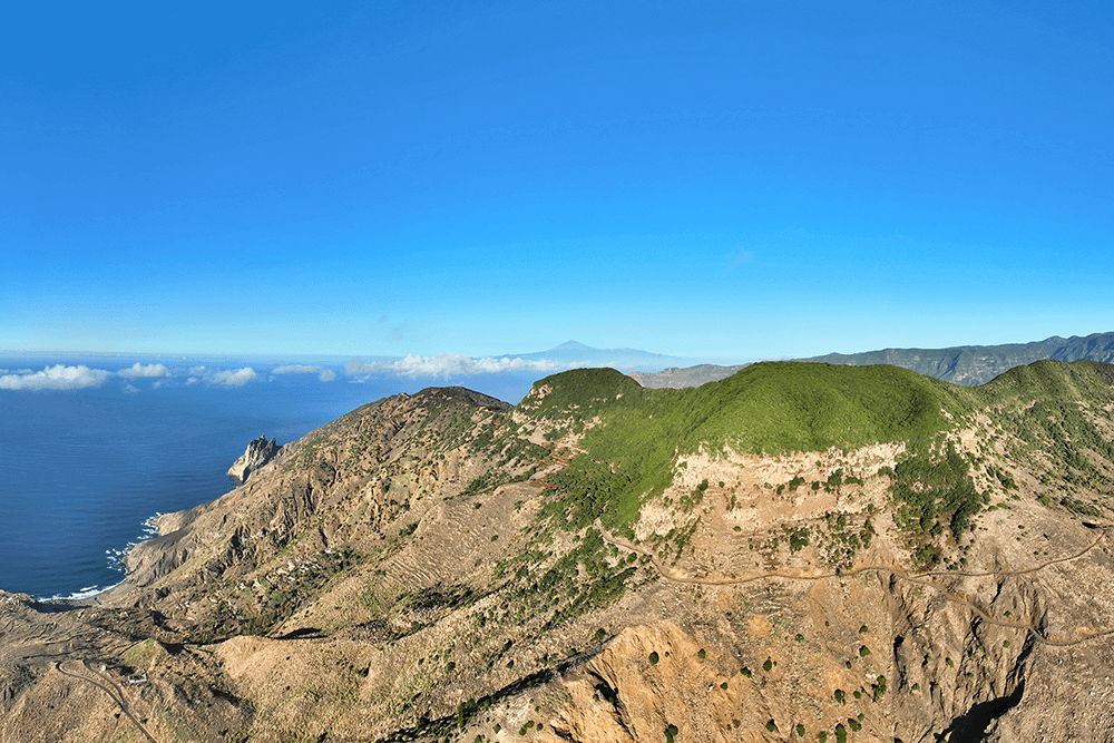
As the route gains altitude, the views open towards the upper areas of Vallehermoso, with fayal-brezal heath and the laurel forest of Garajonay National Park as the main features. This environment reflects the close relationship between the forests and the water capture that sustained local agriculture.
The walk culminates at the Ermita de Santa Clara, a natural viewpoint with panoramas of the Atlantic and the northern cliffs of the island. A place of great spiritual and historical value that rewards the effort of the ascent with a unique landscape experience.
Distance from Point B to Point C / Ermita de Santa Clara – Buda de Arguamul: 1.4 km
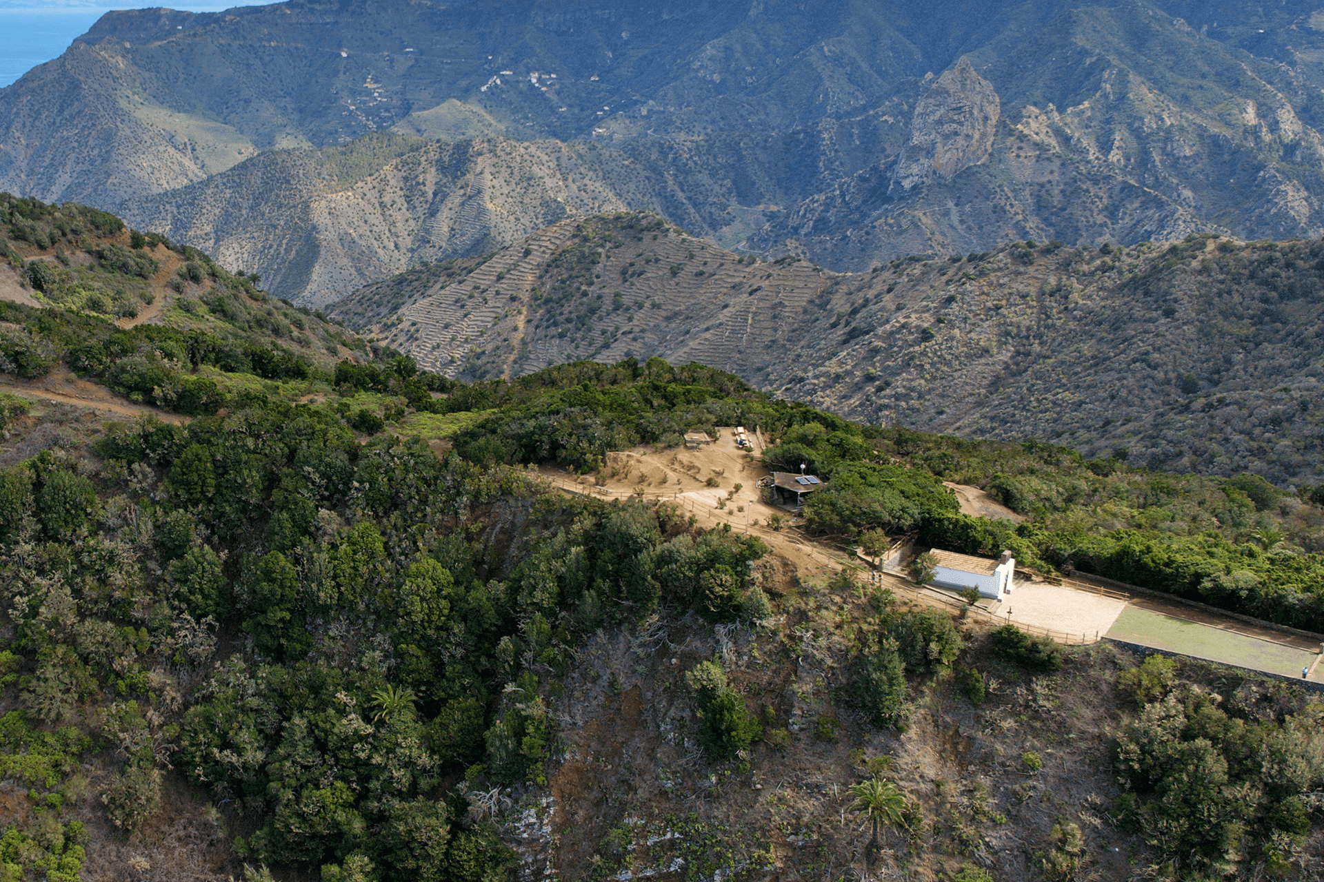
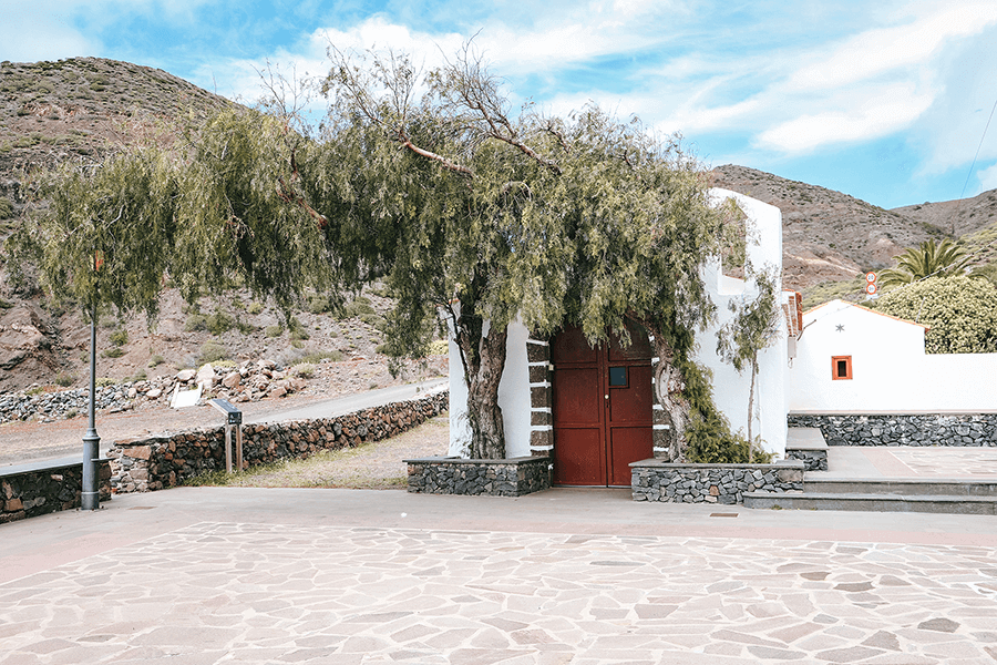
The Ermita de Santa Clara, located on the Teselinde plateau, is a privileged viewpoint with spectacular views of the northern coast of La Gomera, from the Punta del Peligro and Bejira to the hamlet of Arguamul.
Dedicated to Saint Clare, its origin is linked to a local legend about fishermen finding an image of the saint. The current temple, the third to be built in this spot, keeps alive a tradition dating back to the 17th century, celebrated every August.
The path connecting the hermitage with the coast runs along a ridge that offers an impressive geological panorama: on one side, the Roque de Los Órganos, visible only from the sea and formed by eroded lava columns; on the other, Roque Cano, a majestic volcanic plug and symbol of Vallehermoso.
This setting blends history, legend and nature, making the Ermita de Santa Clara one of the island’s most emblematic and photogenic places.
Distance from Point C to Point D / Buda de Arguamul – Arguamul: 1 km
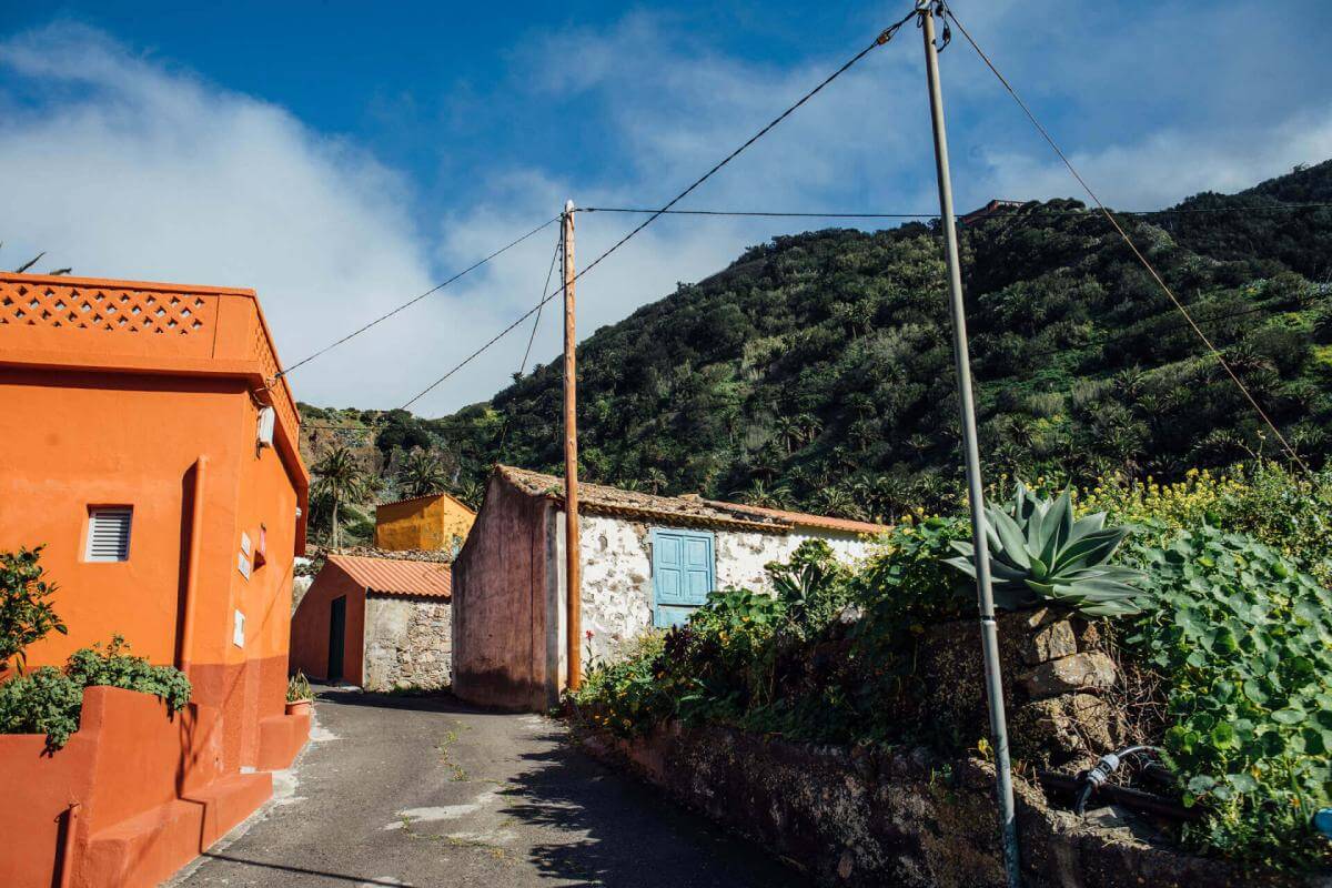
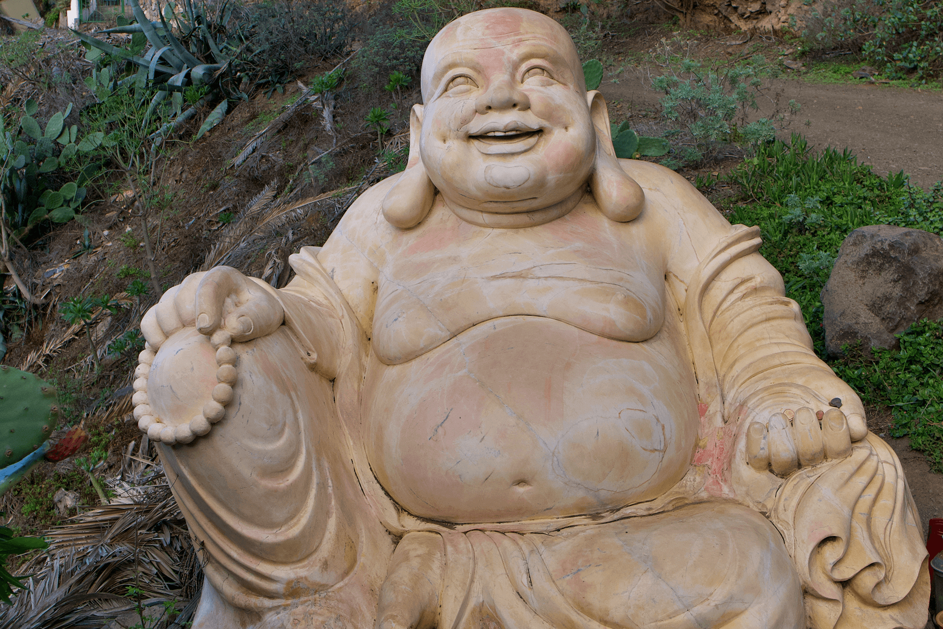
We make a picturesque stop to photograph the Buda de Arguamul, a statue of almost two tonnes that has become a curious and unique attraction in La Gomera. The story behind this Buddha is quite unusual. It was brought from Laos or Thailand by a German couple who bought a house in Arguamul. Due to the difficult terrain, the Buddha never reached the property and was left on a bend in the road leading to the hamlet. Over time, the couple left the island and the statue remained permanently in that spot, where visitors and hikers now stop to take photos with it.
Distance from Point D to Point E / Arguamul – Mirador del Barranco de la Higuera: 1.5 km
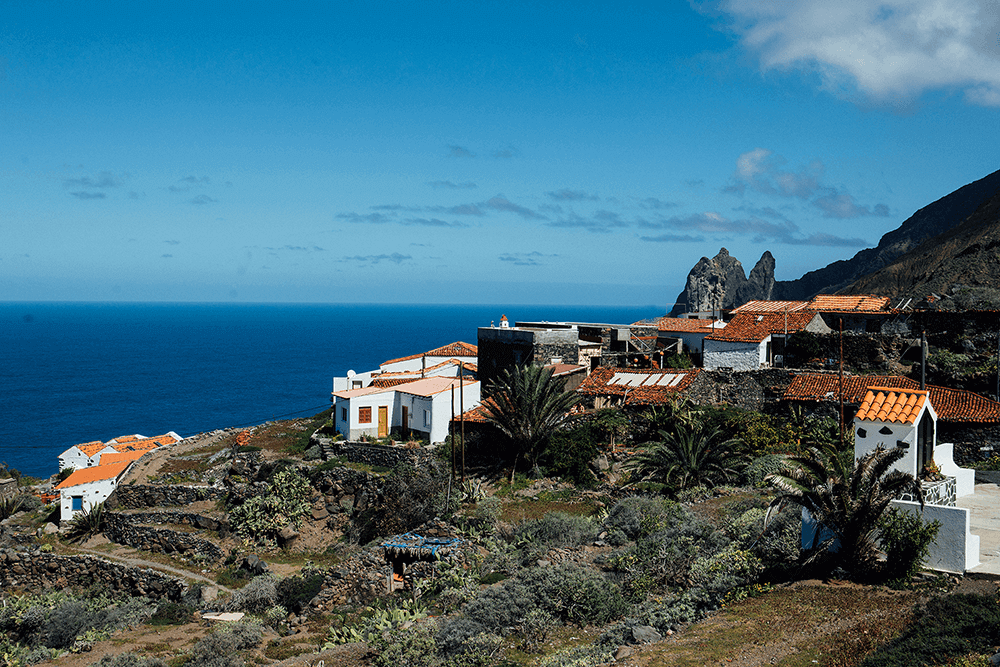
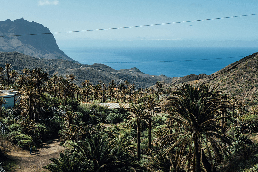
The hamlet of Arguamul, inhabited since the 16th century and home to pre-Hispanic remains such as the Concheros de Bejira, is one of the most authentic and remote places in La Gomera. Located between the peaks of Chijeré and Montaña Bejira, it preserves valuable ethnographic heritage: threshing floors, terraces, wine presses and traditional ovens, all bearing witness to its agricultural and pastoral past.
Its isolation has helped maintain the essence of rural life in La Gomera and a unique landscape where palm trees accompany the three neighbourhoods that descend towards the sea. From the Mirador de Guillama, the views of the Natural Monument of Los Órganos and the Roques de Arguamul are spectacular, and from there it is possible to descend to Playa del Remo.
In earlier times, Arguamul was a prosperous area dedicated to herding, fishing and the cultivation of cereals and tomatoes, which were exported from the pier at Las Salinas.
The trail linking Arguamul with Tazo offers a stunning route through rural landscapes with palm groves and junipers, ideal for enjoying the tranquillity, history and wild nature of north-western La Gomera.
Distance from Point E to Point F / Mirador del Barranco de la Higuera – Ermita de Santa Lucía: 1.4 km
Leaving Arguamul towards Tazo, you follow the road for approximately 1.7 km until reaching a dirt track. There you find the Mirador del Barranco de la Higuera, which offers impressive views over the island’s rugged terrain. From this viewpoint, you can admire the majesty of the ravines unfolding towards the sea, surrounded by a landscape that combines native vegetation with volcanic formations. A trail of about 1 km still remains before reaching Tazo. Upon arrival, the Ermita de Santa Lucía awaits.
Distance from Point F to Point G / Ermita de Santa Lucía – Tazo: 200 m
On the way to Tazo stands what is probably the oldest religious temple on the entire island, as estimates suggest that this hermitage may have been built in the early 15th century. Every 13 December, the day of its feast, hundreds of devotees from across the island and from Tenerife come here. It is also a key point in the hiking routes that run through the hamlet, offering walkers a quiet stop and a place to enjoy the peace of this little-visited corner of La Gomera.
Distance from Point G to Point H: Tazo – Alojera, 4.7 km
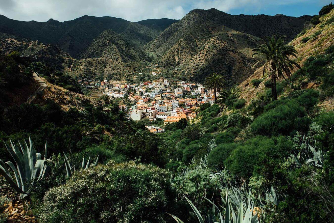
Tazo is a charming and peaceful hamlet in the northwest of La Gomera, within the municipality of Vallehermoso, surrounded by palm groves and old agricultural terraces that reflect its rural tradition and palm-honey production. Its authentic atmosphere and views of the Atlantic Ocean make it an ideal spot for lovers of hiking and nature.
The trail between Tazo and Alojera offers a spectacular route between mountains and sea, passing by the Lomo de Tazo and Montaña de Retamar, with constant panoramic views of the Atlantic.
During the descent, a one-kilometre detour leads to Playa del Trigo, a hidden 300-metre cove surrounded by cliffs — perfect for tranquillity, photography and diving.
This section combines untouched nature, rural isolation and direct contact with the island’s most genuine landscapes.
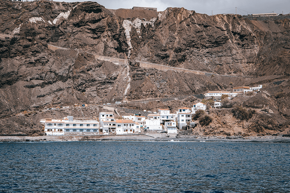
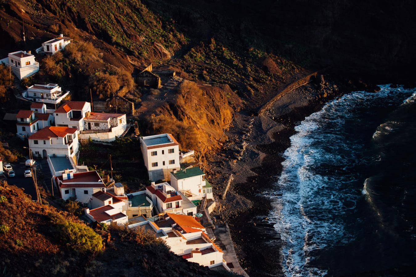
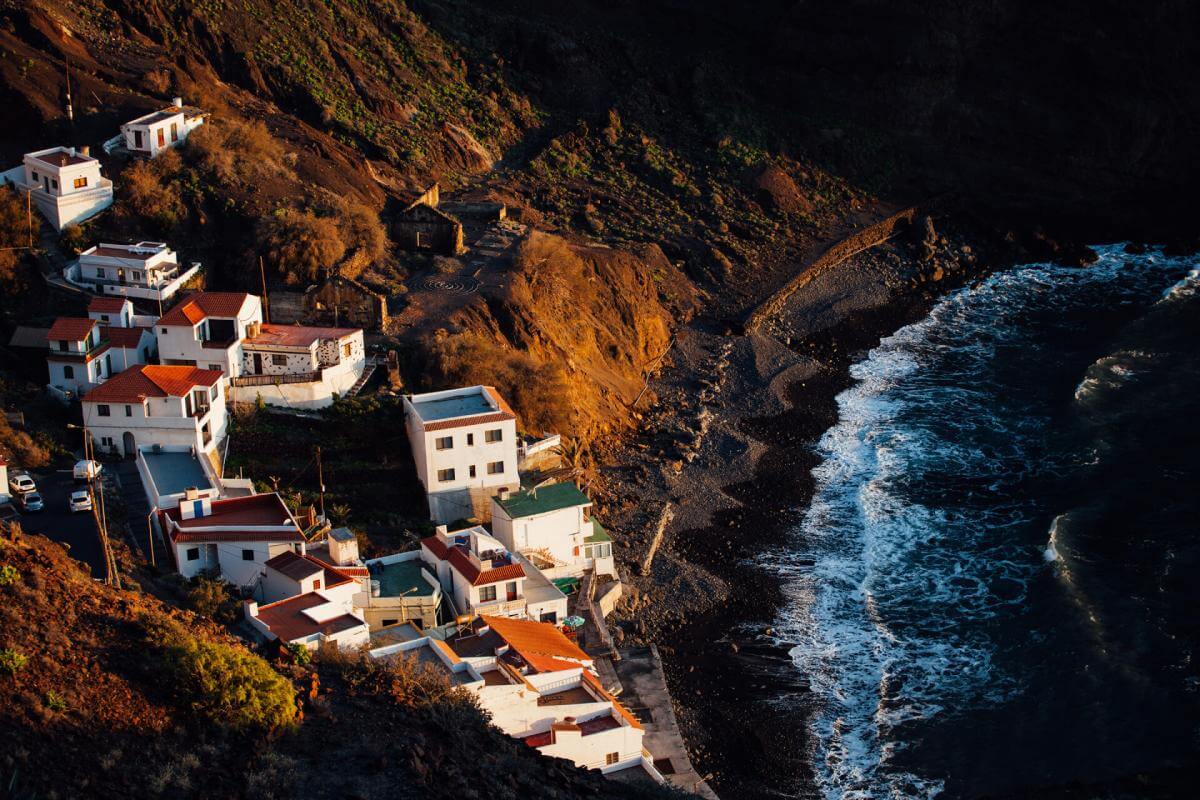
Alojera, in the northwest of La Gomera, is a picturesque village in the municipality of Vallehermoso, known for its rural traditions and for being the island’s main producer of palm honey — one of La Gomera’s most iconic gastronomic symbols. Surrounded by palm groves and ancient agricultural terraces, it preserves rich ethnographic heritage and an authentic atmosphere.
Its black-sand beach, with a small pier and natural pool, is ideal for swimming all year round. Highlights in the village include the Casa de la Miel de Palma, where the traditional production process is explained, as well as several bars and restaurants offering local cuisine with fresh fish and Gomero products.
From the Mirador de la Playa de Alojera, visitors can enjoy magnificent views of the coastline and the volcanic landscape that characterises this peaceful and welcoming corner of the island.
- Never leave waste of any type lying around, including cigarette butts. Leftover food leads to a proliferation of rats and wild cats, which pose a serious threat to the fauna.
- Respect the animals. Do not bother them or feed them. If you see an injured specimen, you can call the emergency number: 112. Do not pick flowers or plants.
- Do not pick up or take away stones or any other item from the natural environment. And do not move them to pile them up into sadly famous 'towers'.
- Respect the signposting along trails. Leaving the set paths causes damage to the environment and could also be dangerous for you and anyone with you.
- It is safer to keep your pet on a lead.
- Try not to alter the peace of the environment with excessive noise (loud music, yelling, etc.).