


Cultural Tourism. The Water Paths
La Gomera


Distancia del Punto A al Punto B Primeraetapa/ Ermita Virgen del Paso: 4,2 Km
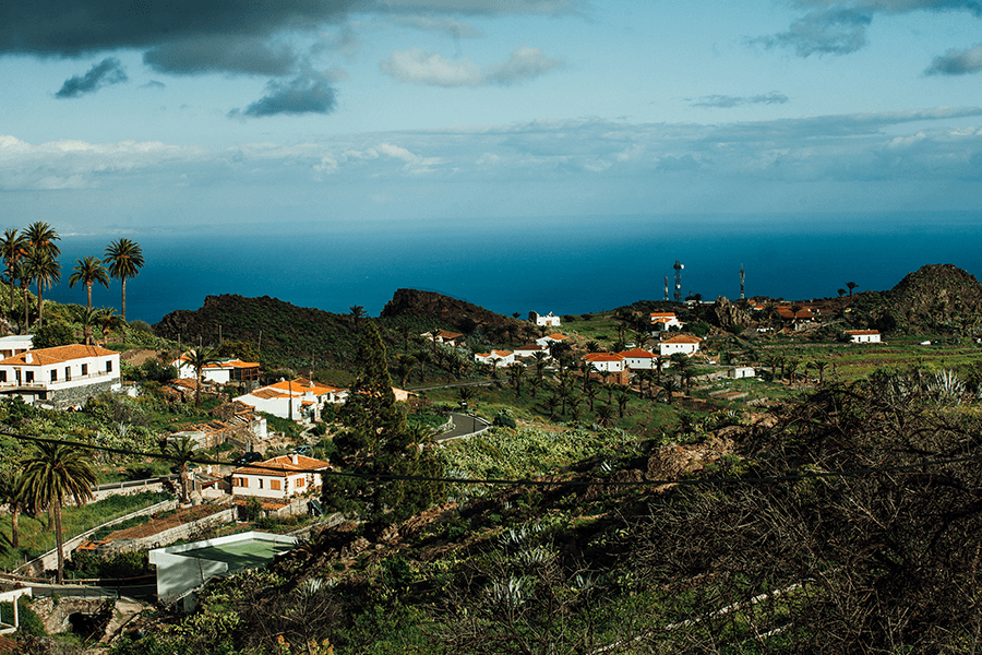
La ruta arranca en el mirador de Alajeró, en la parte alta del casco histórico. Desde aquí se recorren las primeras calles del pueblo, pasando junto a la fuente y el descansadero de la Virgen del Paso, para tomar rumbo norte hacia las medianías. Una salida tranquila que introduce el vínculo histórico entre agua, pastoreo y vida rural.

Distance from Point A to Point B: First stage / Ermita de la Virgen del Paso, 4.2 km
The route begins at the Mirador de Alajeró, in the upper part of the historic centre. From here, the path follows the first streets of the village, passing by the fountain and the resting place of the Virgen del Paso, before heading north toward the midlands. A gentle start that introduces the historical link between water, herding and rural life.
Distance from Point B to Point C: Second stage / Imada, 1.5 km
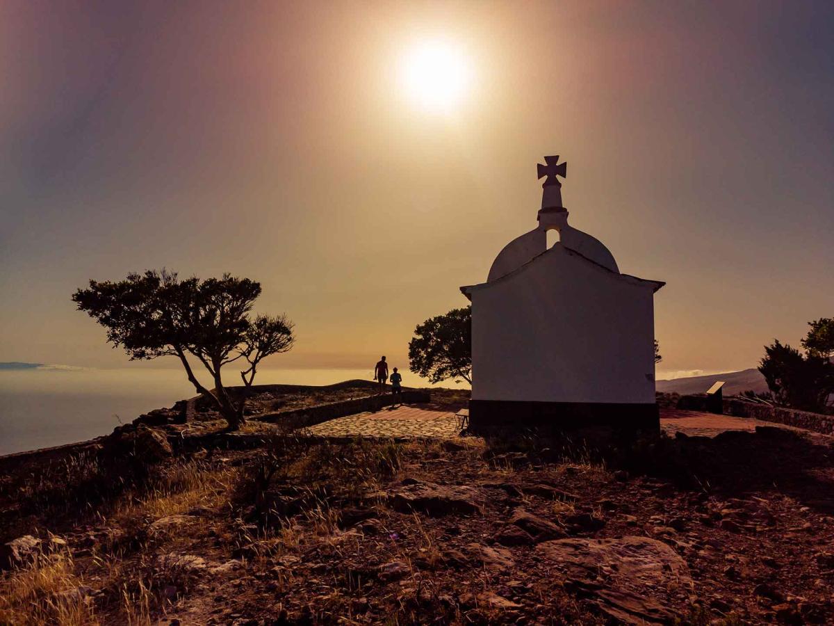
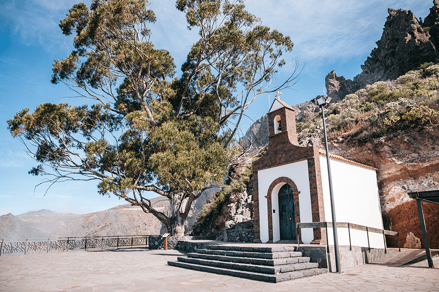
At the head of the basin stands this small chapel, located at an old passage point towards the central plateau. Its position is linked to the gathering of natural resources and to traditional communication routes. From here, the path continues towards Imada.
Distance from Point C to Point D: Third stage / Lasadoy, 2.1 km
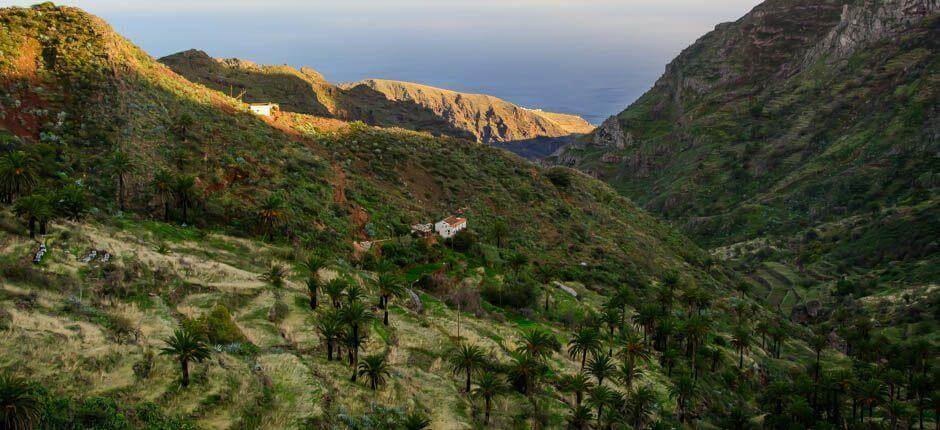
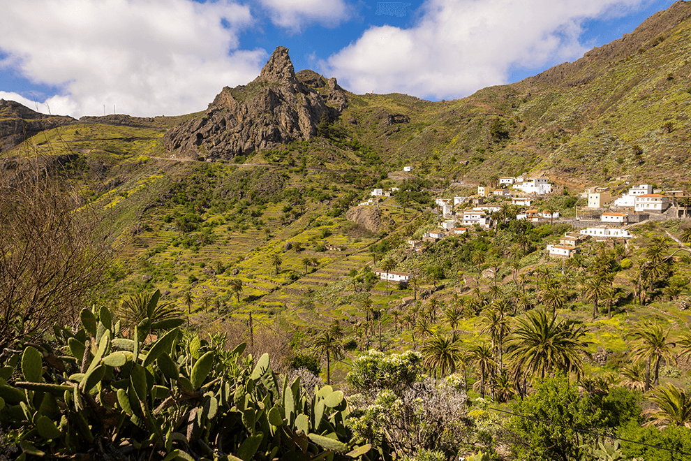
Imada is one of the most beautiful hamlets on the island, sheltered by a rugged volcanic landscape. The settlement sits within a historic agricultural environment fed by the water descending from the hillsides, forming one of the best-preserved rural systems in Alajeró.
Distance from Point D to Point E: Fourth stage / Guarimiar, 5.2 km
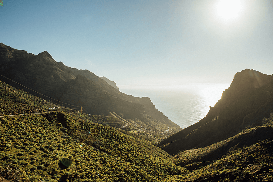
The path continues towards Lasadoy, a stretch where the landscape begins to open toward the Guarimiar ravine. Here, the rugged geology of the area becomes clearly visible, marking the transition into a deeper and more isolated valley.
Distance from Point E to Point F: Fifth stage / Targa, 3.2 km
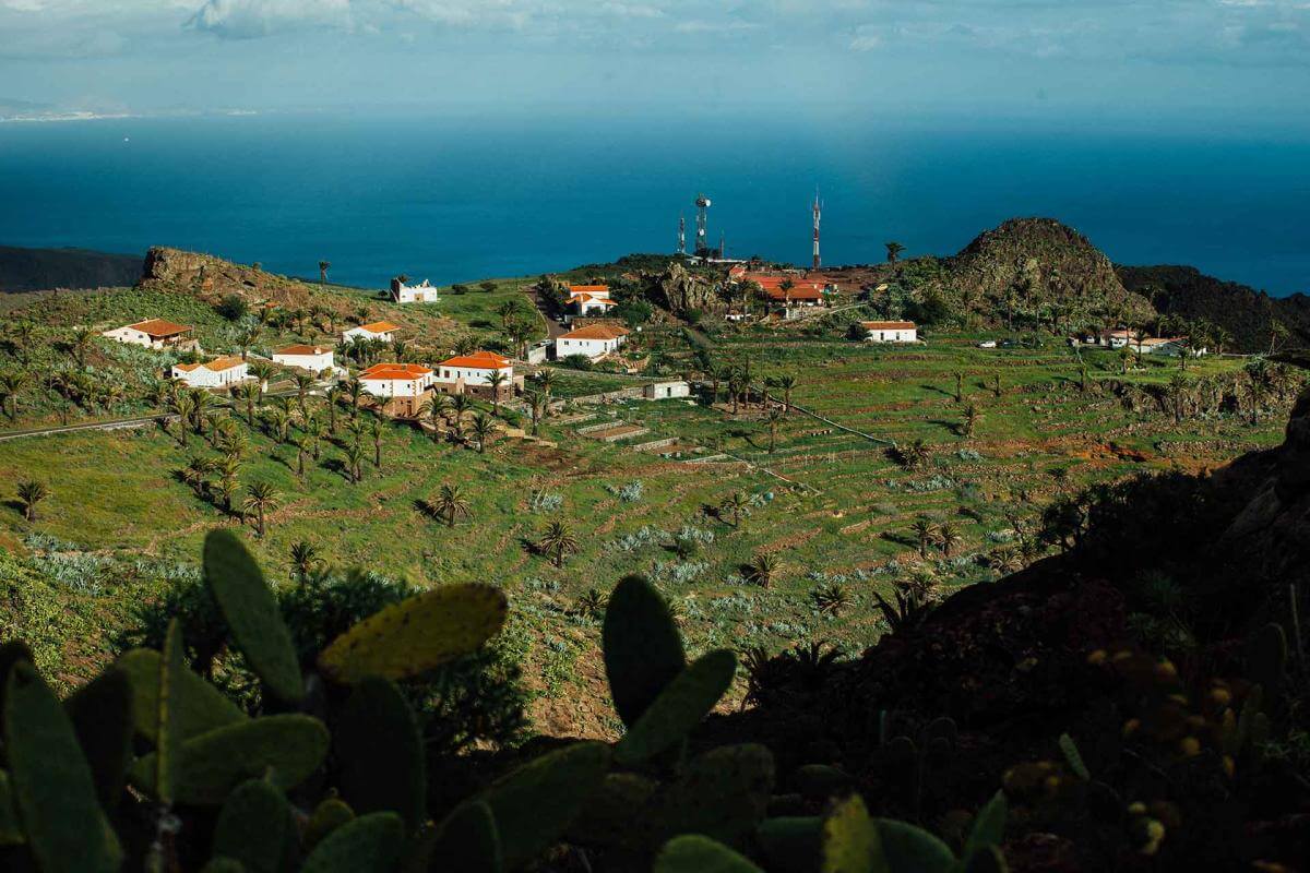
The hamlet of Guarimiar appears between towering volcanic walls, offering one of the most spectacular landscapes of the route. Isolated and enclosed by the ravine, it preserves the primitive character of the gorge, a place of great environmental and cultural value.
Distance from Point F to Point G: Sixth stage / Presa del Sao, 1.9 km
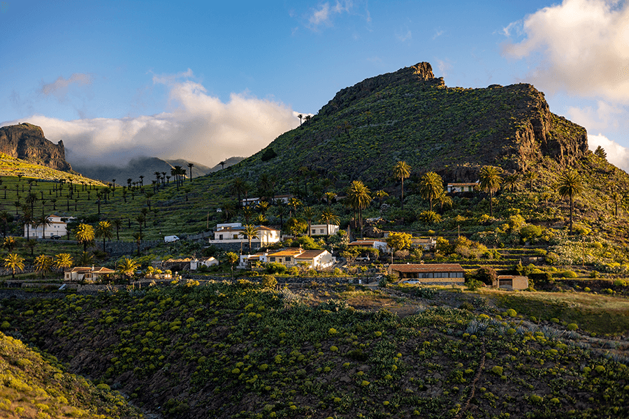
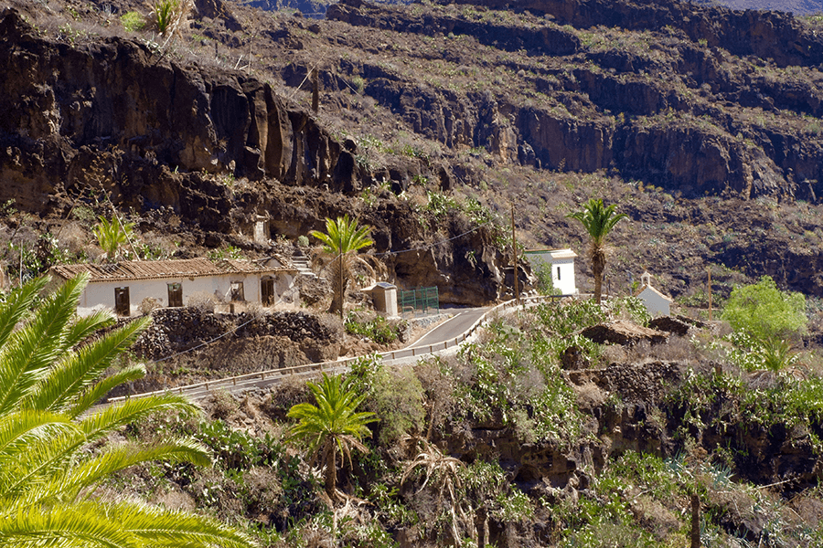
After the ascent through El Rumbazo, the path reaches Targa, one of the oldest historic settlements in the municipality. Its name, of Indigenous origin, is linked to water and to old irrigation channels. The hamlet sits in a hollow framed by Montaña de Valentina and a traditional palm grove.
Distance from Point G to Point H: Seventh stage / Antoncojo, 0.9 km
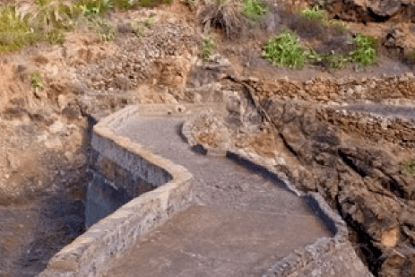
The route reaches the Presa del Sao, part of the large hydraulic system built in the 20th century to support export-oriented crops. It is a clear example of rural engineering.
Distance from Point H to Point I: Eighth stage / Presa de Cardones, 0.5 km
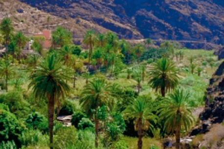
Antoncojo is home to one of the oldest dams on the island, completed in 1920. This area combines terraces, palm groves and former irrigated fields that tell the story of water management and the agricultural boom of the municipality in the early 20th century.
End of the route.
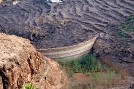
The final stop is the Presa de Cardones, located very close to Antoncojo. It is part of the same historic hydraulic system and concludes the route by showing the scale of the water-storage infrastructure that transformed agriculture in the lower area of Alajeró.
- Never leave waste of any type lying around, including cigarette butts. Leftover food leads to a proliferation of rats and wild cats, which pose a serious threat to the fauna.
- Respect the animals. Do not bother them or feed them. If you see an injured specimen, you can call the emergency number: 112. Do not pick flowers or plants.
- Do not pick up or take away stones or any other item from the natural environment. And do not move them to pile them up into sadly famous 'towers'.
- Respect the signposting along trails. Leaving the set paths causes damage to the environment and could also be dangerous for you and anyone with you.
- It is safer to keep your pet on a lead.
- Try not to alter the peace of the environment with excessive noise (loud music, yelling, etc.).